This study examined whether Rubik’s Cube solving ability is related to spatial visualization skills and stress levels.
Read More...Puzzle to progress: relationship between Rubik’s Cube solving proficiency, spatial visualization, and anxiety
This study examined whether Rubik’s Cube solving ability is related to spatial visualization skills and stress levels.
Read More...A Crossover Study Comparing the Effect of a Processed vs. Unprocessed Diet on the Spatial Learning Ability of Zebrafish
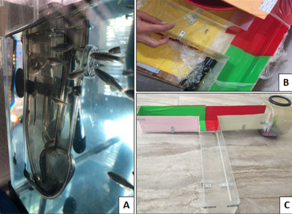
The authors compared the short-term effects of processed versus unprocessed food on spatial learning and survival in zebrafish, given the large public concern regarding processed foods. By randomly assigning zebrafish to a diet of brine shrimp flakes (processed) or live brine shrimp (unprocessed), the authors show while there is no immediate effect on a fish's decision process between the two diets, there are significant correlations between improved learning and stress response with the unprocessed diet.
Read More...Identifying Neural Networks that Implement a Simple Spatial Concept
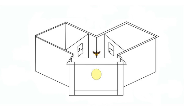
Modern artificial neural networks have been remarkably successful in various applications, from speech recognition to computer vision. However, it remains less clear whether they can implement abstract concepts, which are essential to generalization and understanding. To address this problem, the authors investigated the above vs. below task, a simple concept-based task that honeybees can solve, using a conventional neural network. They found that networks achieved 100% test accuracy when a visual target was presented below a black bar, however only 50% test accuracy when a visual target was presented below a reference shape.
Read More...Human comprehension of 4-dimensional rotation
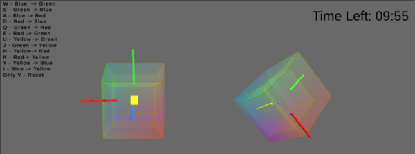
The authors looked at the ability subjects to rotation a 4D cube and how the ability to practice cube rotation impact their ability to understand 4D space.
Read More...Evaluating the clinical applicability of neural networks for meningioma tumor segmentation on 3D MRI
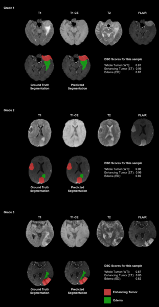
Authors emphasize the challenges of manual tumor segmentation and the potential of deep learning models to enhance accuracy by automatically analyzing MRI scans.
Read More...Comparative study on three machine learning models in novel autonomous drone-based detection of invasive plant Brassica nigra
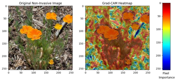
Autonomous drone imaging combined with machine learning offers a promising approach for early detection of invasive species. In this study, students built an autonomous drone and compared three models: CNN, SGDC, and XGBoost, to identify Brassica nigra from aerial footage. Their results show that CNNs most effectively recognize key visual features, demonstrating strong potential for supporting conservation and invasive plant management.
Read More...Identifying shark species using an AlexNet CNN model
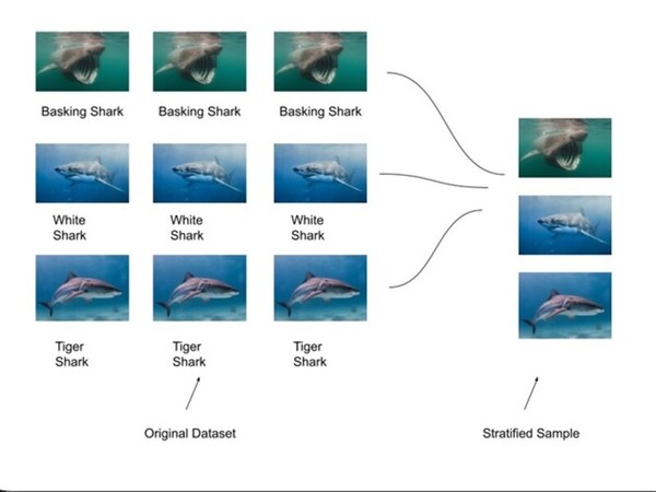
The challenge of accurately identifying shark species is crucial for biodiversity monitoring but is often hindered by time-consuming and labor-intensive manual methods. To address this, SharkNet, a CNN model based on AlexNet, achieved 93% accuracy in classifying shark species using a limited dataset of 1,400 images across 14 species. SharkNet offers a more efficient and reliable solution for marine biologists and conservationists in species identification and environmental monitoring.
Read More...Linear and non-linear summation of responses to visual and olfactory cues in male Drosophila melanogaster
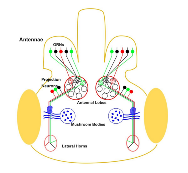
In this study, the authors investigate whether phototaxis and odortaxis in Drosophila melanogaster occurs through linear summation of cues including light and attractive odorants.
Read More...Extending Einstein’s elevator thought experiment to multiple spatial dimensions at the Luxor Hotel & Casino
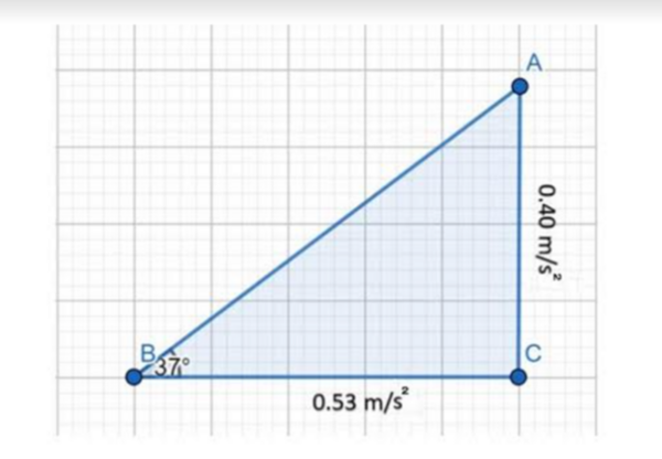
In this study, the authors conduct a series of experiments within an elevator traveling on an angle to determine if Einstein's Equivalency Principle and motion vector decomposition can be used to calculate the angle of inclination.
Read More...Using satellite surface temperature data to monitor urban heat island
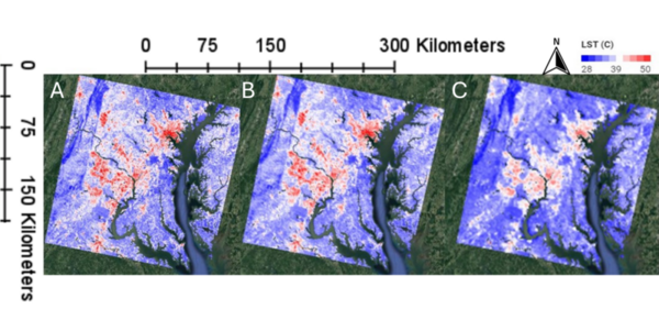
This manuscript investigates the urban heat island (UHI) effect by utilizing two satellite datasets: Landsat (high spatial resolution, lower temporal resolution) and MODIS (lower spatial resolution, high temporal resolution). The authors hypothesized that Landsat would provide better spatial detail, while MODIS would better capture temporal variations. Their analysis in the Washington D.C.–Baltimore region supports these hypotheses, demonstrating that Landsat offers finer spatial details, whereas MODIS provides more consistent seasonal patterns and better detects heatwave frequencies.
Read More...