Paper found that heat waves in India are linked to lower household income, agricultural income, and consumption, with agriculture being affected the most. It also suggests farm workers may adapt to extreme heat over time by increasing labor inputs despite rising temperatures.
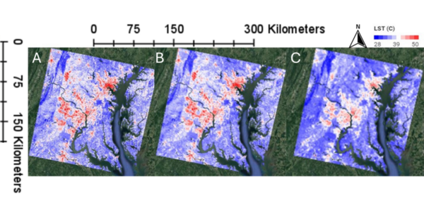
Image credit: Meister, Horvath, and Brown de Colstoun
This manuscript investigates the urban heat island (UHI) effect by utilizing two satellite datasets: Landsat (high spatial resolution, lower temporal resolution) and MODIS (lower spatial resolution, high temporal resolution). The authors hypothesized that Landsat would provide better spatial detail, while MODIS would better capture temporal variations. Their analysis in the Washington D.C.–Baltimore region supports these hypotheses, demonstrating that Landsat offers finer spatial details, whereas MODIS provides more consistent seasonal patterns and better detects heatwave frequencies.
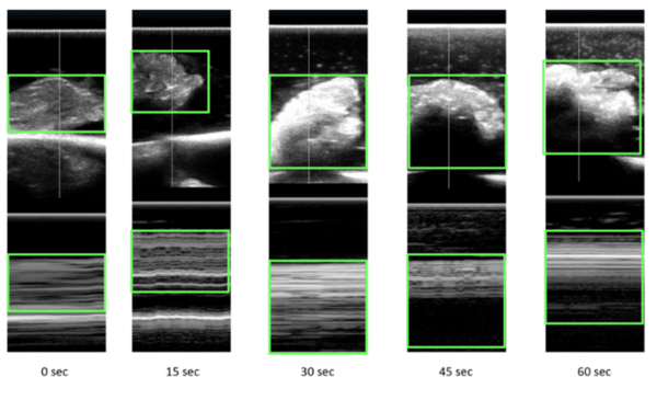
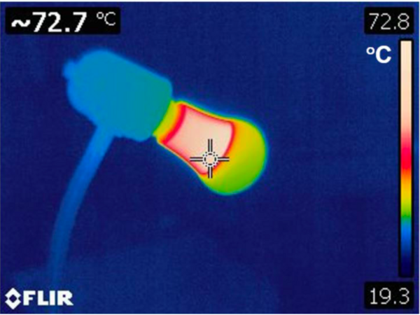
Microwave energy (ME) is used in the medical field to denature protein structures, resulting in inactivation or destruction of abnormal cells. Identifying the extent of destruction of abnormal tissue (cancer tissue or tissue with abnormal electrical activity) is essential for accomplishing successful therapy and reducing collateral damage. Our study was an ex vivo assessment of the changes on ultrasound scans (US) in chicken tissue exposed to ME. We hypothesized that any changes in tissue structures would be recognized on the reflected ultrasound waves. Ultrasound scans of tissues change with exposure to microwaves with increasing reflection of ultrasound waves. With exposure to microwaves, surface level brightness on the ultrasound scans increases statistically significantly. The findings could be used in heat related (ME and radiofrequency) procedures where clinicians would be able to actively assess lesions in real-time. Further studies are required to assess changes in tissue during active exposure to different types of energies.
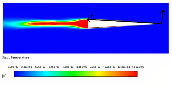
This study's goal was to identify the Mach numbers for which electrostatic drag and heat transfer manipulation would be most applicable inside the stratosphere. The experiments were conducted using computational fluid dynamics software. The study demonstrated that, on average, higher Mach speeds resulted in a considerably higher potential decrease in density. The study highlights that further research on the surface charge method is warranted to explore higher hypersonic speeds within the stratosphere.
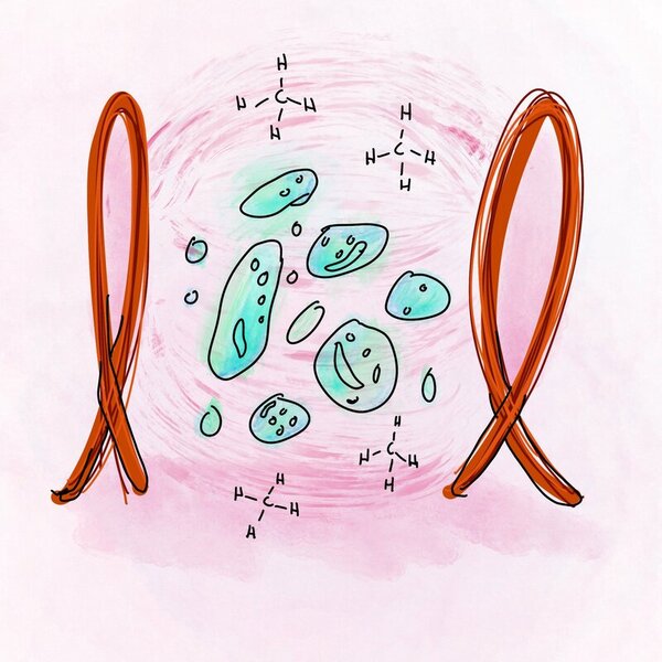
Scientist are investigating the use of methane-consuming bacteria to aid the growing problem of rising greenhouse gas emissions. While previous studies claim that low-frequency electromagnetic fields can accelerate the growth rate of these bacteria, Chu et al. demonstrate that this fundamental ideology is not on the same wavelength with their data.
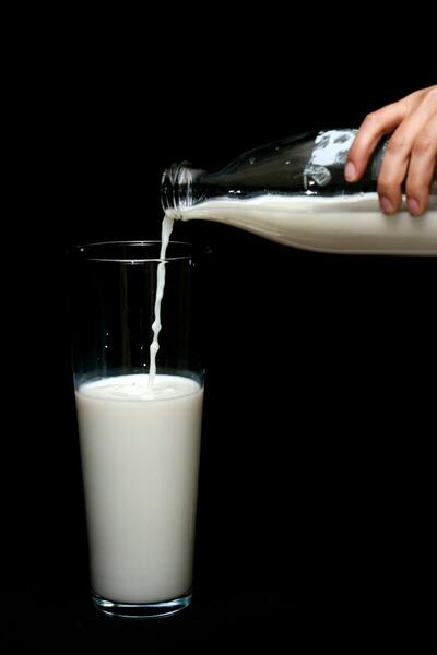
Food spoilage happens when food is not kept in a good storage condition. Qualitatively estimating the shortened shelf life of food could reduce food waste. In this study, we tested the impact of heat on milk shelf life. Our results showed that an exposure at room temperature (25°C) for 3.2 hours will decrease the shelf life of milk by one day.
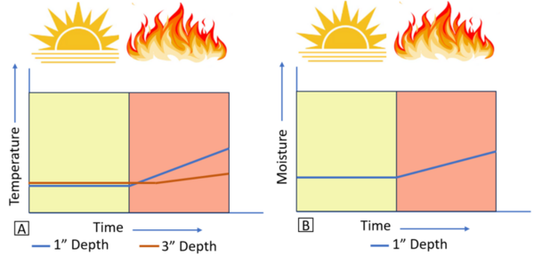
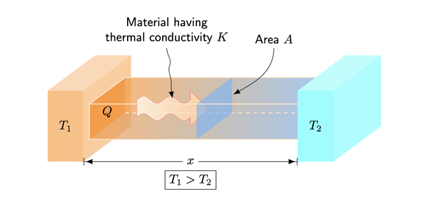
In this experiment, the authors modify the heat equation to account for imperfect insulation during heat transfer and compare it to experimental data to determine which is more accurate.
Here the authors investigate the contributions of man-made surfaces in Laramie, Wyoming to the Urban Heat Island (UHI) effect. Heat absorption and release by five surfaces were measured in the autumn of 2018. By recording temperatures of man-made and natural surfaces at early morning, mid-afternoon, and evening using an infrared thermometer, the authors determined that man-made surfaces retained more heat in fall than natural surfaces.